Like Day 3 ran into Day 4; Day 4 runs into Day 5. The summit was exhilirating and gave everyone a bit of "second wind". But the reality was, we had to get ourselves back down, in the daylight, where we could clearly see what was so cleverly masked in the darkness of the climb. Hmmm, should be interesting......
We had a 1.5 kilometer trek along the rim from Uhuru Peak back to Gilman's Point; then 4 kilometres down the scree slope to Kibo Hut, where we were promised an hour's rest. Once the sun comes out, the frozen scree loosens up and becomes loose and gravelly, which is why they prefer we do this section while frozen. We make surprisingly good time on the descent, even able to almost " foot ski" in the sandy dirt. One hour later - we have made pretty good progress; although I don't know this person and don't even remember taking the picture (you get like that in thin air :)
What took us 7-1/2 hours going up took about 2-1/2 hours to backtrack. As promised, we are able to have tea and rest for an hour before continuing the 12 km hike down across the Saddle desert and back to Horombo Hut, where we had stayed on Night #2. Can you say tired - we fell into bed!
That left 18 km for Day 5, another sunny day with a 7:30 AM start with a rested, recharged group. As I had mentioned earlier this route is labelled the "Coca-Cola"; so we received homemade french fries and cold Coke for lunch at Mandara Hut where we had stayed on Night #1. It was our first drink of pop all week and was a nice treat.
As we ate our lunch, we were treated to a show by the colobos monkeys which were playing around in the forest just below the dining hall.
They are black with a long white tail and white mane across their backside. Oddly enough, they have no thumbs. But they are just a whole lot of fun to watch.
We reach the trailhead at Kilimanjaro National Park by 3PM and complete the necessary sign out procedures and load into the minibus for the return ride to the Springlands Hotel. All I can can say is it is a good job the windows were open on that bus as it had 16 guys who hadn't showered in 5 days!
We have one hour to check-in, get our valuables from lockup and storage, grab a shower and and then meet in the gardens for closing ceremonies. Here you present the tip to the trek staff and we receive our official climb certificates from the National Park.
Hi and welcome to my blog! My friend and I embarked on a trip to Africa in May 2013 to hike Mt Kilimanjaro and I decided to blog the trip. People seem to enjoy following my travels so I will continue to share my treks, trails and travels with you.
If you have any questions, comments or suggestions feel free to email me at blaisemcneil@gmail.com.
Wednesday, May 29, 2013
Monday, May 27, 2013
Day 4 - Summit "The Roof of Africa
Hiking Time: 14 hrs
Total Distance: 27km
Starting Altitude: 4700m
Final Altitude: 3720m (via 5895m)
Habitat: Stone Scree and ice capped summit
Day 4 actually is a continuation of Day 3 with a few hours rest before beginning the ascent at midnight. It is strange to hike at this hour with a headlamp and four layers of clothing on. Less than 100 meters up I feel queasy and earn the "first to puke" game. I realize that I am just too warm for the conditions and once I loosen a layer or two I'm good to go. We travel at this crazy hour as the fine ground is frozen and is easier to traverse. The climb is pretty much an 1100 meter straight up and it is probably just as well we can't see too much or we would be out of there is a flash :)
At 6 AM we reach Gilman's Point, covering a distance of only 4 km since midnight, just as the sun is coming up. We made it! We are pretty exhausted and energy levels are not exactly overwhelming but there are two more milestones - Stella's Point (half hour) and then onto Uhuru Peak (another hour) - a further 210 meters in elevation. The air is so thin that the steps you take between breaths is less and less but you trudge along.
We finally see the famous green sign ahead but is it another one of those mirage moments we experienced the past week. How far away is it really? Are we finally here? Finally, high fives all around as our goal is achieved.
Total Distance: 27km
Starting Altitude: 4700m
Final Altitude: 3720m (via 5895m)
Habitat: Stone Scree and ice capped summit
Day 4 actually is a continuation of Day 3 with a few hours rest before beginning the ascent at midnight. It is strange to hike at this hour with a headlamp and four layers of clothing on. Less than 100 meters up I feel queasy and earn the "first to puke" game. I realize that I am just too warm for the conditions and once I loosen a layer or two I'm good to go. We travel at this crazy hour as the fine ground is frozen and is easier to traverse. The climb is pretty much an 1100 meter straight up and it is probably just as well we can't see too much or we would be out of there is a flash :)
At 6 AM we reach Gilman's Point, covering a distance of only 4 km since midnight, just as the sun is coming up. We made it! We are pretty exhausted and energy levels are not exactly overwhelming but there are two more milestones - Stella's Point (half hour) and then onto Uhuru Peak (another hour) - a further 210 meters in elevation. The air is so thin that the steps you take between breaths is less and less but you trudge along.
The landscape reminds you of pictures of the moon you see on TV. The mountain has a huge central crater and we are actually walking around the crater edge. There is a bizarre squarish glacier of on the other side with Mt Merrill eerily floating next to it.
We finally see the famous green sign ahead but is it another one of those mirage moments we experienced the past week. How far away is it really? Are we finally here? Finally, high fives all around as our goal is achieved.
Sunday, May 26, 2013
Day 3 - Life Above the Clouds
Starting Altitude: 3720m
Final Altitude: 4703m
Habitat: Alpine Desert
After a foggy evening at Horombo Huts, I was stunned by the view that greeted me at 6AM. We were now above the cloud line, like peering out an airplane window - but better :) The sun was just coming up and you realize how lucky you are to be able to stand there and experience this. A quick look back at camp and we "rise again".
Today's itinerary will see another change in terrain to Alpine desert. There will be less plant life; more rocks and dirt. The gain in altitude brings on a minor but dull, steady headache which is not unexpected. We are taking altitude sickness prevention pills so that helps. Our chief guide, Silvano, makes sure that we are always safe!
We finish up mid-afternoon at Kibo Hut and take a short rest. The day is far from over though, as we will be awaken at 11:00 PM for a snack and then will begin the hardest part of the trek - the hike straight up to the Summit.
Day 2 - Moorland
Hiking Time: 6 hrs
Total Distance: 15km
Starting Altitude: 2700m
Final Altitude: 3720m
Habitat: Moorland
Each day usually starts with a wake up call at 6am, breakfast at 6:15 and ready to go by 7:30. Only a few minutes pass before the shady trees of the rainforest are replaced by lower growing vegetation of the habitat they call moorland. Sunblock is necessary today. We catch a good view of the mountain which still seems to be so far away. You have to appreciate the incredible job performed by the porters who sometimes carry one backpack on their back and another on the head/shoulders. They are modern day superheroes !
You begin to feel the small effects of the change in altitude on your body - nothing major, you just get the feeling that something is 'a bit different'. The trail is rocky in many areas so the walking poles are useful to maintain good balance today. The fog begins to roll in in the early afternoon but it does cool things down a bit. We see various types of bushes and plants including the giant groundsel - looks like a cross between a cactus and a palm tree.
For the first time we have a shower of rain but it was no biggie as we were almost at our sleeping quarters for the night Horombo Huts. We were now at 3720 meters.
Saturday, May 25, 2013
Day 1 - Load Up, Head to Marangu
We reached the summit of Mt Kili Thursday at 7:45AM. 3-1/2 days to ascend top and 1-1/2 days to descend. It was an incredible experience ! Just thought it would be fun to give a few day-by-day highlights.
Hiking Time: 5-6 hrs
Total Distance: 12km
Starting Altitude: 1980m
Final Altitude: 2743m
Habitat: Rain forest
We take a bus ride to the Marangu region, where we register at the National Park before hitting the trail. Our team of caretakers for the next five days sing us a song and we quickly head off.
There are many route options for those looking to trek Kili but we chose the Marangu route a.k.a. Coca-Cola route, which has a fairly fast pace at five days but you do get to sleep in huts rather than tents. There is just something about sleeping in a dry sleeping bag and having some (often primitive) facilities.
After registration we walk through a thick rain forest - no need for sunscreen today. We are able to dress in shorts and T-shirts, and as we ramble along we get the first good opportunity to chat with our guide, assistant guide and the two other hikers in our group. Boxed lunches are served and then, for the first of many times, we are told TWENDE TWENDE which is Swahili for Let's Go.
Our destination today is Mandara Hut, a camp with A-frame sleeping huts, dining hall, toilets and staff quarters. The daily routine, after hiking is completed, is the provision of warm wash basins for a quick wipe and then an invite to the dining hall for tea, coffee and yes - even a tray of popcorn. A break follows where you can wander the grounds and chat with others who are also arriving. On the first night we did a hike before dinner for about a half-hour to "climb high sleep low". Really just to acclimate to the elevation. Dinner and then sleep!
Sunday, May 19, 2013
MOSHI - Town Tour
Regular sleep, a body clock that is semi-on-schedule and great meals (and the best coffee in the world) are helping us to feel normal. Today we get to explore our little town of Moshi, home to our little oasis that is the Springlands Hotel. Our guide, Emmanuel, has arranged a shuttle into town where he will guide us on foot through the markets and sights of Moshi.
While waiting for the shuttle, he says we have time to take a walk down the road, across from the hotel, to see the water spring, where locals fill up their buckets with clean water. I meet the cutest kids, one who liked my camera and the other who cried when I took their picture. Emmanuel said he had probably never seen a white man before. We are a scary lot haha.
We continue down along the road to the rice plantation where we get to taste Aloe Vera, that is growing on the side of the road. Emmanuel takes us over to meet a group of locals are outside preparing roasted plantains - served with a hot pepper sauce and they offer us a taste. They were very tasty!
PS In case you didn't know, the pictures can be made big by double-clicking on them.
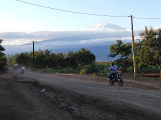
The shuttle delivers us to the downtown area where we explore about three markets, chaotic bus terminal and scale nine flights of stairs in an office building that offers an excellent look off. There is a scenic view of the surrounding area, valleys and of course the mountain. The clouds have cleared from the top of Mt. Kilimanjaro and I still can't fathom that I am going to start climbing it tomorrow.
We pick up a few souvenirs and continue our tour, stopping at the former train station and then back to the shuttle. The temperature today, according to my watch is 40 degrees. Wow! At 4PM we meet out trekking guides for a short meeting to finalize plans for tomorrow. Besides Chris and I, we have Peter from the UK and Rex from Australia. Our leader has done 250 climbs up Mt. Kili so we are in very good hands. We also met the assistant lead who will be joined by 8 porters, 1 waiter and 1 cook to round up our team.
Until our return on Friday, I send a big JAMBO,JAMBO (hello) to everyone following me. We are having a blast, feel great and are ready to go.
                                                                  
While waiting for the shuttle, he says we have time to take a walk down the road, across from the hotel, to see the water spring, where locals fill up their buckets with clean water. I meet the cutest kids, one who liked my camera and the other who cried when I took their picture. Emmanuel said he had probably never seen a white man before. We are a scary lot haha.
We continue down along the road to the rice plantation where we get to taste Aloe Vera, that is growing on the side of the road. Emmanuel takes us over to meet a group of locals are outside preparing roasted plantains - served with a hot pepper sauce and they offer us a taste. They were very tasty!
The shuttle delivers us to the downtown area where we explore about three markets, chaotic bus terminal and scale nine flights of stairs in an office building that offers an excellent look off. There is a scenic view of the surrounding area, valleys and of course the mountain. The clouds have cleared from the top of Mt. Kilimanjaro and I still can't fathom that I am going to start climbing it tomorrow.
We pick up a few souvenirs and continue our tour, stopping at the former train station and then back to the shuttle. The temperature today, according to my watch is 40 degrees. Wow! At 4PM we meet out trekking guides for a short meeting to finalize plans for tomorrow. Besides Chris and I, we have Peter from the UK and Rex from Australia. Our leader has done 250 climbs up Mt. Kili so we are in very good hands. We also met the assistant lead who will be joined by 8 porters, 1 waiter and 1 cook to round up our team.
Until our return on Friday, I send a big JAMBO,JAMBO (hello) to everyone following me. We are having a blast, feel great and are ready to go.
                                                                  
Saturday, May 18, 2013
Chilling at Springlands
Decided to lay low today after a couple of busy travel days. I'll fill you in a bit on our travels that eventually brought us to Moshi, Tanzania.
It was my first time going through London so I was looking forward to experiencing Heathrow. For the five hour layover we just people-watched, had a coffee and chilled. Then off to board our flight to Cairo. In the waiting lounge is where you realize that you are now the minority in a very international crowd. That is what travel is all about! Flight was awesome and then it was a time for a snack and then onto Dar es Salaam.
The big question upon arriving in Dar es Salaam is will our luggage arrive after many connections. We waited at the carousel and after a few anxious minutes we caught sight of our two large MEC bags containing our backpacks. Whew! The airport can best be described as "open-concept" as birds were flying around the semi-outdoor arrivals and departure areas. Not your typical North American security or convenience features. A quick flight over to Kilimanjaro (where we caught our first glimpse of the mountain) and .... We made it......
The hotel is like an oasis in a busy. There are gardens everywhere, an outdoor dining room and lots of outdoor seating areas to just chat and relax. There is a mix of pre and post-climb Trekkers that are either anxious to grab a few last minute tips from those who have just returned and those who share stories about the euphoric (or sometimes nauseas) excitement you experience reaching the summit.
The staff is super friendly, with young Musa - already sporting a Canada pin, is very happy when I give him a Canada patch as well. He told me he "loves Canada".
Friday, May 17, 2013
Arrival in Tanzania
After 28 long hours of flying, we arrived in Moshi this morning (Friday). We were able to get an earlier flight out of Dar Es Salaam to Kilimanjaro so were able to arrive earlier and rest a bit. The drive to the hotel was pretty amazing with loads of people out walking, working the fields, and manning the shops. We are looking forward to our time here!
Thursday, May 9, 2013
A Repeat Visit to Big Tancook Island
Big Tancook Island, located about six miles from Chester, N.S. is a real gem. There is a phrase "third time's a charm" - well this is my third trip on the William G. Ernst ferry that departs Chester, stopping first at Little Tancook and then arriving at Big Tancook about ten minutes later. The trip total is about sixty minutes one-way at the exorbitant cost of $5.25 RETURN (the cost of a large latte at Starbucks). Arrival time 11:00AM.
The big change this time is no bicycles were taken - it was strictly a walking tour. Turning right from the dock we pass the cafe (still closed for the season), post office, church and school. The roads are all dirt and the occasional pickup drives past with a usual toot of the horn. Judging by the passengers I saw on the ferry, my guess is we are the only two "tourists" here today.
I just dug out my map and I noticed that the island is shaped a bit like a whale with it's tail flipped up so using that visual, we trek to Southern Head or the "tip of the whale's tail". There are lots of fishing boats working close to shore, I guess pulling up traps. Since the bikes were at home, one could explore trails a bit further by foot to the end of the island before grabbing a bit of lunch at a super nice open, picnic spot.
Returning on a loop that takes you across the whale's back is the beach area where a favorite past time on Tancook can be enjoyed - collecting sea glass. Tons of green and brown, some clear/frosted white and this time I finally scored two blue pieces. Hey, they were small but thats OK as those blue gems had escaped me on past visits. Pockets are filled with rocks and it is time to move along.
     Moving along past the library, gallery and museum area you hook back onto the main road. Passing the dock (quick scan - yip the ferry is still there !), we head towards the whale's mouth where houses are a bit more plentiful and residents get a waterfront view from just about everywhere. The Gift Shop, where I was able to purchase a few knick-nacks before is still closed for the season. On this end of the island, the search is on for the appearance of the under sea cable that provides power to the island (working for the power company you look for weird shit like that :-). It's a bit after 4:00 PM and there is time for a rest in the little park overlooking the wharf.
I love this place! You are off the beaten track, yet you can see Blandford off to the side and Chester off in the distance. Besides fishing, there is little industry here yet they have better Internet reception than I get in downtown Halifax. People here seem to be a pleasant mix of blue collar and funky artistic. We board the ferry for the trip back to Chester. Departure time 17:00PM.
The big change this time is no bicycles were taken - it was strictly a walking tour. Turning right from the dock we pass the cafe (still closed for the season), post office, church and school. The roads are all dirt and the occasional pickup drives past with a usual toot of the horn. Judging by the passengers I saw on the ferry, my guess is we are the only two "tourists" here today.
Returning on a loop that takes you across the whale's back is the beach area where a favorite past time on Tancook can be enjoyed - collecting sea glass. Tons of green and brown, some clear/frosted white and this time I finally scored two blue pieces. Hey, they were small but thats OK as those blue gems had escaped me on past visits. Pockets are filled with rocks and it is time to move along.
     Moving along past the library, gallery and museum area you hook back onto the main road. Passing the dock (quick scan - yip the ferry is still there !), we head towards the whale's mouth where houses are a bit more plentiful and residents get a waterfront view from just about everywhere. The Gift Shop, where I was able to purchase a few knick-nacks before is still closed for the season. On this end of the island, the search is on for the appearance of the under sea cable that provides power to the island (working for the power company you look for weird shit like that :-). It's a bit after 4:00 PM and there is time for a rest in the little park overlooking the wharf.
I love this place! You are off the beaten track, yet you can see Blandford off to the side and Chester off in the distance. Besides fishing, there is little industry here yet they have better Internet reception than I get in downtown Halifax. People here seem to be a pleasant mix of blue collar and funky artistic. We board the ferry for the trip back to Chester. Departure time 17:00PM.
Sunday, May 5, 2013
Urban Hike: An Alternative to the Tranquil Trail
I googled Urban Hike and here is what I found on the urbandictionary.com website: "An urban hike is an outdoor activity that consists of walking long distances, usually with a backpack, in urbanized outside environments, often following sidewalks, concrete bike paths, paved roads with the objective of arriving at destinations of shopping, dining or other entertainment."
The winter/spring shoulder season left many wooded trails still wet or snow covered, so for the next two weekends we explore the urban hike. No gas, no car keys, no maps or compasses - just comfy hiking shoes and a few bucks in your pocket.
The first weekend was a circular trip around the Halifax peninsula from tip to tip. From downtown, central Halifax we head thru the 'funky' north end: Gottingen St ~ Novalea ~ Seaview Park, which is located below the MacKay Bridge overlooking the Bedford Basin (former Africville community). It was a cloudy day but nice for a walk.
After a quick break to take a few pictures, we leave the north end via Leeds/Agricola St until we came across the army surplus store. Having never been in before, it was worth dropping in and taking a quick look around. A few blocks later was a stop into Cafe Aroma Latino for an excellent coffee-to-go, with a few unexpected purchases to take home: coconut soda and a bottle of Latino hot sauce. It's a good job I have my backpack! This urban hike concept is pretty cool - it is hard to find a coffee shop in the backwoods of Colchester county.
We cross the Halifax Commons back in the central Halifax area and head towards the south end of town following Robie St ~ St Mary's University ~ Point Pleasant Park. We complete the outside perimeter of PPP, around the container pier and finish up our hike back downtown. Yes, a bit tired but felt good about what had been accomplished that day. Even better, it makes for a great Google map.
The following weekend was a trek around the City of Lakes - Dartmouth. Across the MacDonald Bridge (otherwise known as the Old Bridge) we walk thru downtown Dartmouth, making a pit stop at a drug store for Kleenex and Cadbury Creme Eggs - well I didn't stop for creme eggs but heck, they were marked down to almost nothing. It would be a sin to leave them there (can I quote you Lisa!) . Prince Albert Rd along Lake Banook has excellent paved pathways closer to the lake than the road - nice. We turn off Locks Rd and enter Shubie Park, Dartmouth's largest park with the famous Shubie Canal and locks criss-crossing the park.
I enjoy the peace and quiet of the park environment until we exit next to the "not so peaceful" Micmac Mall. It is inevitable that we need to go back uphill no matter which route you take so we head up behind the mall onto Woodland Avenue. A quick stop at the grocery store for some naan bread to accompany the butter chicken that is simmering at home in the slow cooker, back across the Old Bridge and home for a hot cup of tea followed by a delicious dinner of Indian food.
Each weekend urban hike had a distance of 18km or 19km but it lets you see your city from a different perspective. Even though I have run most of those distances and routes over the years for marathon training, you tended to strap on the headphones and boot it. Being able to stop for a coffee or treat is a nice change.
The winter/spring shoulder season left many wooded trails still wet or snow covered, so for the next two weekends we explore the urban hike. No gas, no car keys, no maps or compasses - just comfy hiking shoes and a few bucks in your pocket.
The first weekend was a circular trip around the Halifax peninsula from tip to tip. From downtown, central Halifax we head thru the 'funky' north end: Gottingen St ~ Novalea ~ Seaview Park, which is located below the MacKay Bridge overlooking the Bedford Basin (former Africville community). It was a cloudy day but nice for a walk.
After a quick break to take a few pictures, we leave the north end via Leeds/Agricola St until we came across the army surplus store. Having never been in before, it was worth dropping in and taking a quick look around. A few blocks later was a stop into Cafe Aroma Latino for an excellent coffee-to-go, with a few unexpected purchases to take home: coconut soda and a bottle of Latino hot sauce. It's a good job I have my backpack! This urban hike concept is pretty cool - it is hard to find a coffee shop in the backwoods of Colchester county.
We cross the Halifax Commons back in the central Halifax area and head towards the south end of town following Robie St ~ St Mary's University ~ Point Pleasant Park. We complete the outside perimeter of PPP, around the container pier and finish up our hike back downtown. Yes, a bit tired but felt good about what had been accomplished that day. Even better, it makes for a great Google map.
The following weekend was a trek around the City of Lakes - Dartmouth. Across the MacDonald Bridge (otherwise known as the Old Bridge) we walk thru downtown Dartmouth, making a pit stop at a drug store for Kleenex and Cadbury Creme Eggs - well I didn't stop for creme eggs but heck, they were marked down to almost nothing. It would be a sin to leave them there (can I quote you Lisa!) . Prince Albert Rd along Lake Banook has excellent paved pathways closer to the lake than the road - nice. We turn off Locks Rd and enter Shubie Park, Dartmouth's largest park with the famous Shubie Canal and locks criss-crossing the park.
I enjoy the peace and quiet of the park environment until we exit next to the "not so peaceful" Micmac Mall. It is inevitable that we need to go back uphill no matter which route you take so we head up behind the mall onto Woodland Avenue. A quick stop at the grocery store for some naan bread to accompany the butter chicken that is simmering at home in the slow cooker, back across the Old Bridge and home for a hot cup of tea followed by a delicious dinner of Indian food.
Each weekend urban hike had a distance of 18km or 19km but it lets you see your city from a different perspective. Even though I have run most of those distances and routes over the years for marathon training, you tended to strap on the headphones and boot it. Being able to stop for a coffee or treat is a nice change.
Subscribe to:
Posts (Atom)